NOAA’s Aggressive Hurricane Season Forecast and Tropical Activity Overview
**NOAA Announces Historic Hurricane Season Forecast Amid Tropical Activity**
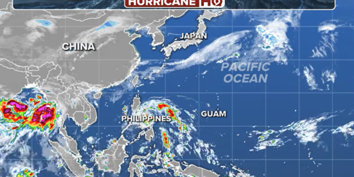
As the Atlantic hurricane season approaches, the Northern Hemisphere has already started to demonstrate its cyclonic potential, with the year’s first tropical cyclone, Aghon, developing near the Philippines. This development marks an unusually slow start to the season in the western Pacific, which doesn’t have a fixed cyclone season like the Atlantic but typically sees most activity from May through October. Aghon’s appearance solidifies 2024 as having the fifth-slowest start in the region, with the latest first cyclone record held by June 8, 1983.
The NOAA has issued what is considered its most aggressive hurricane season forecast on record, despite the Pacific’s slow start. On average, the season sees 26 storms, with 16 escalating to typhoon status, a benchmark not met since 2019. Typhoons, akin to hurricanes in the Atlantic, feature sustained winds of at least 74 mph. Aghon is expected to strengthen into a tropical storm north of the Philippines, posing a primary threat of heavy rainfall to the Southeast Asian country as sustained winds stay below 40 mph.
Meteorological organizations worldwide monitor the Pacific, with cyclone naming varying by region. The Philippine Atmospheric, Geophysical and Astronomical Services Administration (PAGASA) oversees the southwest basin, including Aghon, while the United States Joint Typhoon Warning Center and Japan’s meteorological agency track other areas, each using different naming conventions.
This year’s outlook hints at a quieter season for the western Pacific, potentially influenced by the transition from El Niño to La Niña conditions by fall. As global weather patterns continue to evolve, the world watches closely, hoping for a season that defies the grim forecasts.
[Visual aids include satellite imagery of the Western Pacific Ocean and the expected track of Aghon, courtesy of FOX Weather.]

