Central American Gyre: Key to Predicting Tropical Storms
Meteorologists Eye Central America for Tropical Cyclone Clues in Early Summer
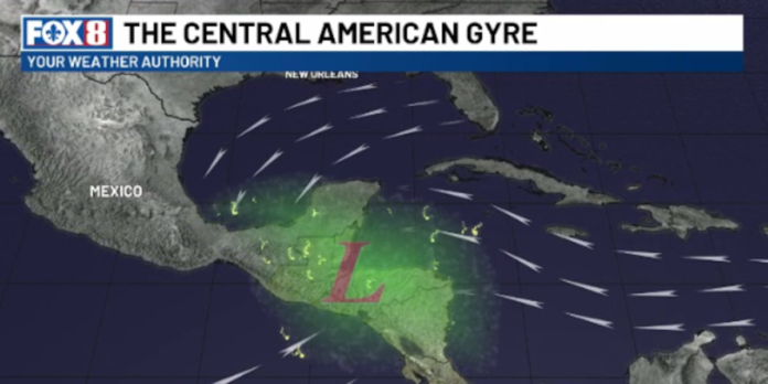
NEW ORLEANS – According to recent observations, meteorologists are closely monitoring Central America for early indications of tropical cyclone formations during May and June, a critical period for understanding the genesis of these potentially devastating natural phenomena. The formation of a broad low-pressure area, known as the Central American Gyre, over this region is a significant factor in the early summer and fall. This gyre, extending several hundred miles, plays a pivotal role in the development of tropical moisture, leading to torrential rainfall, mudslides, and flooding, particularly in the mountainous areas of Central America.
The gyre’s rotating motion is also responsible for ejecting energy outward, which can lead to the formation of tropical waves or seeds that may develop into tropical storms and hurricanes once they move over the warm waters of the Caribbean and the Gulf of Mexico. However, the predictability of these events is challenging. Research by the National Weather Service’s Environmental Modeling Center has indicated that not all models, including the Global Forecast System (GFS), are reliable in predicting the formation of tropical waves from the Central American Gyre, often forecasting storms that do not materialize.
Meteorologists are urging the public to exercise caution when interpreting storm forecasts on social media and websites, especially those predicting landfall weeks in advance. With the Central American Gyre being a significant source of energy for June storms, understanding its dynamics is crucial for accurate forecasting and preparedness.
(WVUE Fox 8)

